
Map & Climate of Botswana
Explore Botswana’s geographical layout and climate, from its vast Kalahari Desert to the lush Okavango Delta. This landlocked nation in Southern Africa spans 581,730 km², bordered by South Africa, Namibia, Zambia, and Zimbabwe, with a climate that ranges from semi-arid to subtropical.
Plan Your Journey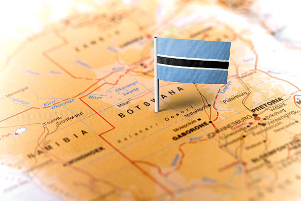
Map of Botswana
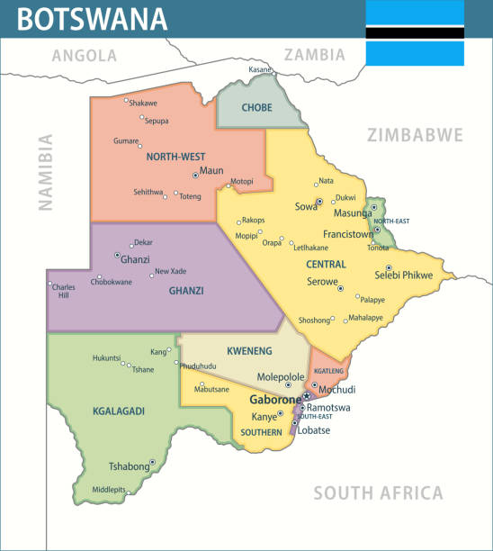
Botswana’s geography is defined by its expansive Kalahari Desert, covering about 70% of the country, and key regions like the Okavango Delta in the northwest, a UNESCO World Heritage Site. Major cities include Gaborone (the capital), Francistown, and Maun, a gateway to the Delta. The Chobe River in the north supports rich biodiversity, while the Limpopo River forms part of the southern border with South Africa.
Key locations on the map include:
- Gaborone: The political and economic hub in the southeast.
- Maun: The tourism capital near the Okavango Delta.
- Kasane: Near Chobe National Park, known for elephant herds.
- Ghanzi: A cultural center in the Kalahari for San communities.
Climate of Botswana
Overview
Botswana has a semi-arid climate with hot summers and mild winters. Annual rainfall averages 250–600 mm, mostly during the wet season (November–March), with the northwest receiving the most rain due to the Okavango Delta’s influence.
Seasons
Wet Season (Nov–Mar): Temperatures range from 25–35°C, with frequent thunderstorms.
Dry Season (Apr–Oct): Cooler nights (5–15°C) and warm days (20–30°C), ideal for safaris.
Regional Variations
The Kalahari is drier and hotter, with extreme temperature swings (0–40°C). The Okavango Delta and Chobe regions are more humid, supporting lush vegetation and wildlife year-round.